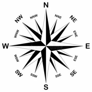
The extreme geographic compass points are the most Northern, Eastern, Southern, and Western points in Virginia. For good measure, Extreme Geography Virginia includes all 16 of the main geographic points- North, North-northeast, Northeast, East-northeast, East, East-southeast, Southeast, South-southeast, South, South-southwest, Southwest, West-southwest, West, West-northwest, Northwest, North-northwest.
North 
North
Bonus! This point is also the NNW point.
Coordinates
39°27’57.6″N 78°20’49.5″W
39.465991, -78.347084
Location
Northern tip of Frederick County Virginia, Morgan County West Virginia
Access
The best access is from Cacapon Resort State Park near Omps WV, about 9 miles south of Berkeley Springs WV. From the park entrance, it is a 9.8-mile circuit using Cacapon Lodge Drive, Middle Fork Road, and Overlook Trail. You can drive or hike. There is parking at the Cacapon State Park Nature Center that will save about a mile round trip. The road is closed seasonally, often closed from November 1st until April 1st. Check with the park authorities for dates.
Marker, sign, monument
There is no official marker. A tree near the site is marked with tape. There is an official survey marker about 30 feet north of the point.
North-northeast
North-northeast
Coordinates
39°18’19.9″N 77°33’56.8″W
39.305534, -77.565772
Location
Loudoun County Virginia, Frederick County Maryland at the Potomac River. Maryland owns the river making the point on the south shore of the Potomac River, near Lovettsville, Virginia.
Access
Please note that this location is on private property, use one of the two “Good Enough” points. Please respect private property and do not trespass.
There are two “Good Enough” points, one in Virginia and one in Maryland. The Maryland one is slightly closer to the actual point.
Marker, sign, monument
None
“Good Enough” point Virginia
Coordinates
W39°18’04.7″N 77°34’28.8″W
39.301310, -77.57466
Location
Near Lovettsville, Loudoun County, Virginia.
Access
The end of Ropp Lane, about 5 miles from Lovettsville Virginia
“Good Enough” point in Maryland
Coordinates
39°18’39.7″N 77°34’07.5″
39.311037, -77.568752
Location
Near the Catoctin Creek Aqueduct on the towpath of the Chesapeake and Ohio Canal National Park, Frederick County Maryland.
Access
Parking is available at the C&O Canal Lock 29, the park entrance is on Lander Road, about 6 miles from Brunswick Maryland. Walk northwest along the C&O towpath to the Catoctin Creek Aqueduct. It is a 1.5 mile round trip easy walk.
Northeast
Northeast
See East. Bonus! This point is also the ENE and E point.
East-northeast
East-northeast
See East. Bonus! This point is also the NE and E point.
East
East
Bonus! This point is also the NE and ENE point.
This point is a subject of debate among Geographers. When determining geographic extremes, should islands be counted, or only the mainland? If islands count, how do you define an island? Does it have to be above water at low tide or only at high tide? Does a sandbar or a rock that is only above the surface at low tide count? How big does it have to be to count? If there is a 1-foot square rock or sandbar two hundred yards offshore that is above the water at high tide, would that count? Well, I will let you decide! I am giving you three options. You are welcome!
If you count islands
The most eastern point is on Assateague Island where the Virginia-Maryland border meets the Atlantic Ocean.
Coordinates
38°01’37.3″N 75°14’31.7″W
38.02702, -75.24213
Location
Virginia-Maryland border at the Atlantic Ocean, Assateague Island National Seashore, Accomack County, Virginia
Access
This point can be accessed from either Maryland or Virginia. The Assateague Island National Seashore maintains a fence at the VA-MD border to contain the wild Assateague horses, also called Chincoteague ponies.
From Maryland’s Assateague State Park it is a ~40 mile round trip with a 4-wheel drive approved Over Sand Vehicle. Permits and restrictions apply.
From Chincoteague Virginia it is a ~ 25 mile round trip hike, partly on gravel roads and partly on the beach. You will travel through the Chincoteague National Wildlife Refuge and the Assateague Island National Seashore. Contact both for access rules, hiking and camping information and permits.
Marker, sign, monument
A fence marks the Virginia-Maryland border.
If only the mainland counts
Coordinates
38°00’54.6″N 75°22’37.8″W
38.015164, -75.377165
Location
Accomack County, Virginia and Worcester County Maryland at the Chincoteague Bay water line, near Greenbackville, Virginia.
Access
Please note that this location is on private property. Please respect private property and do not trespass.
Marker, monument
None
“Good Enough” point
Coordinates
38°00’51.1″N 75°23’18.6″W
38.014198, -75.388497
Location
Near Greenbackville, Accomack County, Virginia
Access
The “Good Enough” point is just north of where Front St (MD), Mumford St. (VA) and Franklin City Rd (VA) intersect on the Virginia and Maryland border.
Marker, monument
VA-MD state line
East-southeast
East-southeast
See Southeast. Bonus! This point is also the SE and SSE point.
Southeast
Southeast
Bonus! This point is also the ESE and SSE point.
Coordinates
36°33’01.4″N 75°52’03.3″W
36.550390, -75.867508
Location
Virginia Beach, Virginia and Currituck County North Carolina border at the Atlantic Ocean
Access
Access from Virginia
The point can be accessed by passing through the Back Bay National Wildlife Refuge to False Cape State Park. Both have numerous rules and restrictions that are too numerous to mention here. Park at Back Bay, there is no parking at False Cape State Park. It can be accessed by foot, bike, paddle craft and a limited running tram. The point is ~ a 12-mile round trip hike from the entrance to False Cape State Park
Marker, sign, monument
A fence marks the Virginia-North Carolina border.
Access from North Carolina
It is 34-mile one-way drive from Kitty Hawk in the Outer banks to the point. The first 23 miles to Corolla are on paved roads, the last 11 miles to Carova are on the beach. This drive is not for everyone or all vehicles! Do your research and prepare well.
Marker, sign, monument
A fence marks the Virginia-North Carolina border.
South-southeast
South-southeast
See Southeast. Bonus! This point is also the ESE and SE point
South
South
Much of the Virginia border with North Carolina appears as a flat line of latitude at small scale. At larger scales, small variations appear as the line zigzags slightly. The most southern part is a long flat stretch of more than 60 miles that starts in Pittsylvania County about 10 miles west of Danville through the city of Danville to Halifax County, and on to the John H. Kerr Reservoir in Mecklenburg County. The latitude of this section varies little more than the length of a football field. Analysis of a dataset from the Virginia GIS Clearinghouse, produced by the Virginia Geographic Information Network, a part of the Virginia Department of Emergency Management has the most definitive data and puts the southern point at the western edge of the city of Danville.
Coordinates
36°32’27.1″N 79°28’10.3″W
36.540850, -79.469538
Location
Intersection of the west edge of the city of Danville, Pittsylvania County Virginia and Caswell County North Carolina
Access
None. This location is dangerously located on a ramp in a cloverleaf interchange of US 58 and US 29. Use the Alternate location or one of the “Good Enough” points described below Do not attempt to stop here.
Marker, sign, monument
None
Alternate location
Coordinates
36°32’27.0″N 79°28’16.4″W
36.540826, -79.471217
Location
Near the intersection of the west edge of Danville City, Pittsylvania County and North Carolina
Access
On Greentree Rd at the Virginia – North Carolina border
“Good Enough” section
“Good Enough” 60-mile section. There are many places along these 60 miles of border than can count as a “Good Enough” point. There is little variation of in the latitude of the border from the western part of Pittsylvania County to the John H. Kerr Reservoir in Mecklenburg County. Anywhere along this border is “Good Enough”
“Good Enough” section start
Coordinates
36°32’29.6″N 79°36’17.2″W
36.541567, -79.604785
Location
Pittsylvania County Virginia, Rockingham County North Carolina about 12 miles from Danville.
Access
VA880 Stateline Bridge Road, south end of the bridge over the Dan River at the Virginia – North Carolina line.
“Good Enough” section end
Coordinates
36°32’28.4″N 78°35’06.4″W
36.541223, -78.585123
Location
Mecklenburg County Virginia, Granville County North Carolina
Access
Arrowhead Lane off of Lick Branch Road at the Virginia – North Carolina line.
South-southwest
South-southwest
See West. Bonus! This point is also the SW, WSW, W, and KY-TN-VA tri-state point.
Southwest
Southwest
See West. Bonus! This point is also the SSW, WSW, W and KY-TN-VA tri-state point.
West-southwest
West-southwest
See West. Bonus! This point is also the SSW, SW, W and KY-TN-VA tri-state point.
West
West
You reach this point by hiking the route of the Wilderness Road through the Cumberland Gap National Historic Park, the route first used by Daniel Boone and other Europeans to cross the Appalachian Mountains to Kentucky.
Bonus! This point is also the tri-state point of KY-TN-VA, and the SSW, SW, and WSW point.
Coordinates
36°36’02.9″N 83°40’31.5″W
36.600811, -83.675408
Location
Lee County Virginia, Claiborne County TN, Harlan County KY, Cumberland Gap National Historic Park, near Cumberland Gap TN.
Access
The best access point is from Cumberland Gap TN. There is a parking lot at the end of Pennlyn St. The point can be reached by the Tennessee Road Trail, Wilderness Trail and the Tri-State Peak Trail. Hiking Distance roughly 2.2 miles round trip, 626 feet elevation gain
Marker, sign, monument
Very nice pavilion with monuments
West-northwest
West-northwest
You reach this point by hiking the route of the Wilderness Road through the historic Cumberland Gap, the route first used by Daniel Boone and other Europeans to cross the Appalachian Mountains to Kentucky.
Coordinates
36°36’11.1″N 83°40’28.5″W
36.603092, -83.674585
Location
Lee County Virginia, Harlan County KY, near Cumberland Gap TN.
Access
The best access point is from Cumberland Gap TN. There is a parking lot at the end of Pennlyn St. The point can be reached by the Tennessee Road Trail, the Wilderness Road Trail, and the Tri-State Trail. About .4 of a mile past the Cumberland Gap marker you will pass back into Virginia. The point is about 120 feet to the north. Continue another .2 of a mile to the VA-TN-KY tri-state point.
Marker, sign, monument
None
Northwest
Northwest
Note: The NW point as determined by the standard methodology (See Methodology section) is about a ¼ mile from the SW and W points. Some people may look at this location on a map and think that it seems wrong and not pass a “common sense” test. Given the unique shape of Virginia, slightly concave facing the northwest and with a high ratio of longitude to latitude, it is likely that the methodology may be inappropriate for this case. If you think so, let me know and see the alternate point below. If you think the methodology is correct, enjoy visiting the NW point on your hike to the West point and you just saved yourself a trip to Highland County!
You reach this point by hiking the route of the Wilderness Road through the historic Cumberland Gap, the route first used by Daniel Boone and other Europeans to cross the Appalachian Mountains to Kentucky.
Coordinates
36°36’16.9″N 83°40’23.2″W
36.604685, -83.673115
Location
Lee County Virginia, Harlan County KY
Access
The best access point is from Cumberland Gap TN. There is a parking lot at the end of Pennlyn St. The point can be reached by the Tennessee Road Trail and the Wilderness Road Trail. When you reach the Cumberland Gap marker just past the Virginia-Kentucky state line, the point is about 250 feet to the northeast. Given the steep nature of the Gap, this point is Good Enough! Continue another .6 of a mile on the Tri-State Trail to the VA-TN-KY tri-state point.
Marker, sign, monument
None
Alternate NW location:
For those of you who feel the actual northwest point doesn’t seem right, I give you an alternative!
Coordinates
38°35’29.4″N 79°38’56.7″W
38.591512, -79.649073
Location
Highland County Virginia, George Washington National Forest and Pocahontas County West Virginia Monongahela National Forest about 28 miles north of Monterey VA.
Access
Located about 500 feet west of the intersection of Allegany Rd and Owls Knob Hollow Road, about 10 miles northeast of Bartow West Virginia.
Marker, sign, monument
None
North-northwest
North-northwest
See North. Bonus! This point is also the N point.
© 2023 by Extreme Geography LLC. All rights reserved. Trademark pending for “Extreme Geography”