What is Extreme Geography?
Have you ever wanted to stand in one place and be in three states at once? Or wanted to stand on the most northern/southern/eastern/western place in Virginia? Welcome to Extreme Geography Virginia!
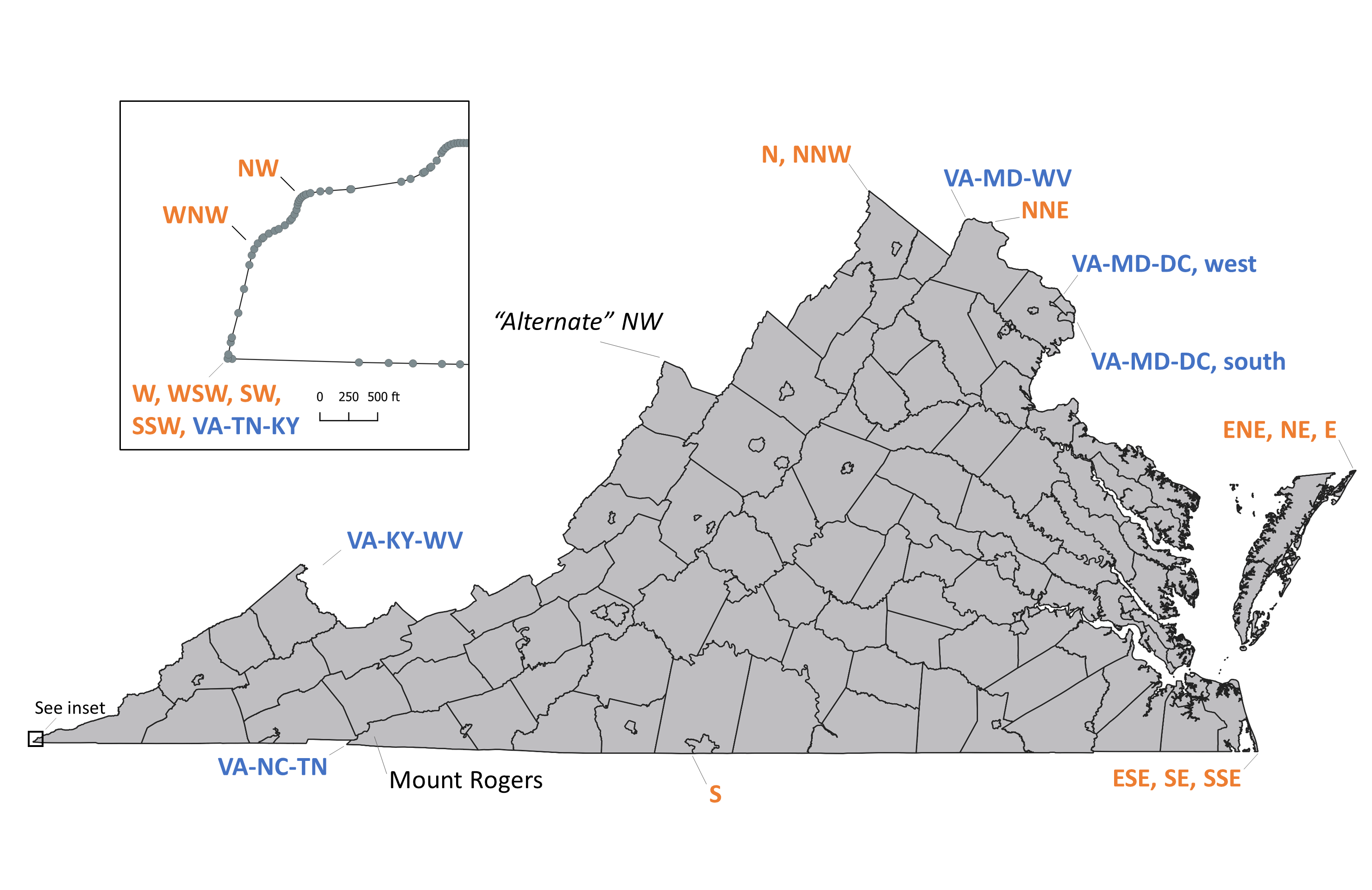
Extreme geography can be divided into these categories


Be safe!
Trails can be rerouted, and storms can close access. Some of the remote sites have little or no cell service. Be sure to save any maps or directions to your phone. It is not our fault if you hike Assateague in a hurricane or Mt. Rogers in a blizzard or try to ford a raging Tug Fork. Thanks, folks, be safe!
Have fun!
Extreme Geography’s purpose is educational. Whether you are curious about the extreme geographic sites in Virginia, or want to visit all of them, we hope you will use this site to explore, have fun, and learn about Virginia. Our intent is to promote these sites and to give you an idea of the level of effort to reach the sites.
Trip planning
We will help you with initial trip planning. In most cases this site will direct you to a parking area near a trail head but will not give detailed instructions on accessing the points. There are many hiking apps and websites with detailed trail information. Most of the extreme geography points are on public land, contact the appropriate government agency when planning your trip and for last minute trail conditions.
Private property
Some of these locations are on private property. Please respect private property and do not trespass. For those locations, we indicated the “Good Enough” point that is close enough to the extreme geographic location to count as a visit.
About
This site was created by Alan McDowell. I am a geographer, cartographer, a hiker and geography nerd. I hope you use this site to explore weird places in Virginia!
© 2023 by Extreme Geography LLC. All rights reserved. Trademark pending for “Extreme Geography”